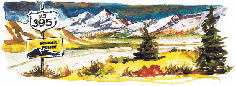
U.S. 395 offers a gateway to unparalleled scenery
Designated a scenic route along much of its length, U.S. 395 skirts the eastern slope of the Sierra Nevada Range west of the Nevada border, providing year-round access to outdoor adventures and unparalleled scenery. It runs through historic towns, paces tumbling streams, overlooks lakes, traverses ranch lands and climbs foothill summits. Alpine resorts, winter sports areas, fishing areas, campgrounds and trailheads lie along a network of connecting side roads.
Vacationing Southern Nevadans reach U.S. 395 from several points. Summertime travelers often choose the major access at Bishop, Calif., reached by way of U.S. 6 from Coaldale Junction north of Tonopah off U.S. 96. The official scenic highway designation of U.S. 395 begins at Bishop and runs north almost to Carson City.
If you have an adventurous bent, try the road from U.S. 95 over Lida Summit and Westgard Pass to big Pine, then head north to Bishop. The twisting, precipitous, 90-mile route passes close by the ancient Bristlecone Pine area in the White Mountains. Access Nevada's remote Fishlake Valley from this road.
The 13,000-foot peaks of the Sierras rise abruptly from valleys at the base of the eastern slope. Snow-fed creeks and rivers carve deep canyons and pool into lakes, creating an angler's paradise. Fish camps, rustic resorts and campgrounds near fishing streams dot these canyons. Anglers need California licenses, available locally. Stands of aspen crowding the water in the canyons create one of the top areas for fall color in the West, beginning next month.
Several side roads invite exploration. Follow Highway 203 to the resort community at Mammoth Lakes, a popular winter sports area. Stop at the national forest regional information station for maps and trail guides, then drive into a gorgeous region along the San Joaquin River. Try the splendid walk along the river to the geological oddity at Devil's Postpile National Monument. Just when you think the views from the highway can't get any better, you top a summit to see the expanse of snaggle-tooth crags called the Minarets.
Turn off U.S. 395 for the 16-mile June Lake Loop, popular with mountain bikers. June Lake village offers summer and winter recreation. Four mountain lakes lie along this loop, havens for fishermen, boaters, campers and hikers.
Scenic highways through several passes leave U.S. 395 to breach the wall of mountains. All open to travel in summer, a few close with winter snows.
Perhaps the most spectacular, the road through Tioga Pass accesses Yosemite National Park through its high backcountry. Compared to the traffic in Yosemite Valley, the Tioga Pass route seems uncrowded. A park entry fee applies.
Mono Lake dominates the valley near the turnoff to Tioga Pass. The Mono Basin Scenic Area's visitor center near Lee Vining introduces this region of recent volcanism. Salty Mono Lake fosters a brine shrimp that attracts large numbers of birds. At least 300 species live or visit there. Where the lake's mineral-laden underwater springs meet the briny lake water, unusual tufa flowers form, revealed along its shoreline. Mono Lake Tufa State Reserve east of U.S. 395 on Highway 120 preserves and interprets a portion of these formations.
U.S. 395 links many historic towns proud of their Western heritage. Open all year from 10 a.m. to 4 p.m., the Laws' Railroad Museum near Bishop celebrates the importance of the narrow gauge railroad to mining, logging and ranching. Housed in an 1880s schoolhouse, the Mono County Museum in Bridgeport concentrates on regional history, including American Indian artifacts. Bodie Ghost Town, a popular California state historical park, lies a few miles off US 395 between Lee Vining and Bridgeport. Original buildings preserve a colorful era when mining was king.
Headed north through ranching country in Antelope Valley, U.S. 395 passes through a trio of historic towns, Coleville, Topaz and Walker. The West Walker River shares its canyon with the highway for 14 thunderous miles of boulders and rapids. Designated a wild and scenic river from its source in the Sierras to the town of Walker, the river calms as it meanders through the valley toward Nevada.
Margo Bartlett Pesek's column appears on Sundays.